Everest Expedition: When Fairy Tales Become History
Mount Everest. Peak Fifteen of the Himalayas. Elevation 8,848 meters. By the mid-19th century, calculations had already confirmed that this is the highest peak on earth. On 29 May 1953, humans stood on the summit of Everest and touched the sky—Tenzing Norgay and Edmund Hillary. Since then, this day has been celebrated worldwide as Everest Day. That ascent did not end humanity’s attraction to Everest. Even today, climbers from every corner of the Earth set their sights on it, hoping to rewrite that same fairy tale in their own way.
We too once set out towards Everest. The day was 1st April 2010. Two climbing members: Basanta Singh Ray and I. Three supporting members: Ashok Ray, Bibhas Sarkar, and Sourav Sinchan Mondal.
We flew from Kolkata Airport to Kathmandu. Our Sherpa friend Pemba came to receive us at the airport. And from him came the bad news: we had not received permission to enter from the Tibet side. The Chinese government was not allowing any Indian to enter Tibet. The sky seemed to fall on our heads. So much preparation, so much expense, so many dreams—would everything be ruined just because of administrative and diplomatic issues?
But through the efforts of our agency, Loben Expeditions, we finally received permission to climb Everest via Nepal. The expedition would not be from Tibet, i.e., not via the North Col. We would have to go through the South Col—costing a little more.
For a day or two, we strolled around nearby areas, buying mountaineering equipment. On 5 April we began our journey, and in just half an hour on a small plane we reached the Hillary–Tenzing Airport in Lukla (2,842 m). This route is also known as the Hillary–Tenzing Route.
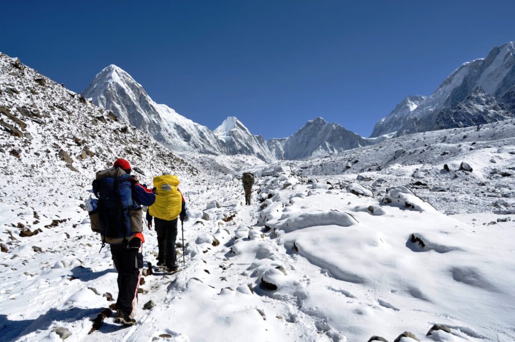
Next morning, trekking began at 8:15 a.m. The trail led north. A wide path going along the Dudhkoshi River. Sometimes crossing from left to right via bridges, sometimes from right to left. Passing Chiplang and Nurning, we reached Phakding at 2,610 meters. After lunch there, we continued.
From Benkar, crossing the river, we climbed a steep stretch. Then appeared a pretty village, Manju. This is the entrance to the Sagarmatha Sanctuary Park. After crossing the Dudhkoshi again via a suspension bridge, we reached Jorsale—2,740 meters.
Next morning, after crossing the Dudhkoshi, the continuous climb began. After ascending quite a bit, we reached a broad stone-paved space—Everest View Point. From there, we caught our first glimpse of the queen of fairy tales—Mount Everest. Climbing further, we finally reached Namche Bazaar, at an elevation of 3,440 meters.
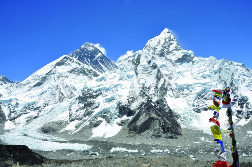
The next day we climbed up to Syangboche. There is a small airstrip here—planes land and take off amid soil, sand, and gravel. These small aircraft are used mainly for carrying goods. A little higher lies the Everest View Hotel. From here the views of Everest, Lhotse, and Nuptse are magnificent. To the right stands Mt. Ama Dablam—scenery that steals the heart.
A bit higher up, we could see two beautiful villages far below—Khunde and Khumjung. Once they were mere tiny settlements; now they are well-developed. All thanks to Sir Edmund Hillary—it is through his efforts that the hospital, school, and market here were established.
Leaving Namche Bazaar, the path moved northeast. Everest, Lhotse, and Nuptse ahead; Ama Dablam slightly to the right; Dudhkoshi flowing below. After climbing further, we reached Teshing—3,380 meters. Crossing a bridge over the Dudhkoshi River, the trail ascends steeply.
We reached a four-way junction: the path we came from Namche; the left path leading to Khumjung; straight ahead the trail to Gokyo; and the right turn leading to Tengboche, our route. Tengboche lies on the very top of a hill—3,860 meters. This is where the region’s largest Buddhist monastery stands.
From Tengboche, we trekked to Pangboche—3,930 meters. Here is the oldest monastery in the region.
Then we moved northeast along the Imja Khola River. From here the trail grew more barren—no trees anymore. At noon we reached Dingboche, 4,445 meters. We halted there for the night.
The next day, after leaving Dingboche, we climbed further. Along the way stood many Chortens decorated with colourful prayer flags. From Dingboche the route turned northwest. The only companions along the path were juniper shrubs, stones, and gravel.
Following this trail, we reached Thokla at 4,620 meters. To the right lay the Khumbu Glacier. Beginning at the foot of Lhotse, the Khumbu Glacier ends here at Thokla. From this point, the trail follows the right side of the Khumbu and heads almost directly north.
The next day, we started from Thokla at 8 a.m. A long, continuous ascent. Within two hours we reached Lobuche—4,910 meters. The following day again we began at eight. All around us were various famous, named and unnamed peaks. There was no sign of trees or shrubs, not even grass—only snow mixed with rocks, soil, and gravel.
Right in front stood a magnificent peak—Pumori, 7,134 meters. To its right was Lingtren, 6,713 meters. Further right, Khumbutse, 6,639 meters. Just beside it lay the Lho-La Pass, 6,026 meters. Behind the Lho-La Pass peeked Tibet’s Changtse Peak. Those who climb Everest via the North Col have to keep Changtse to their right and ascend along its left flank.
And to the right of Lho-La stood Everest’s West Shoulder at 7,268 meters. From beside this, the peak of Nuptse, 7,864 meters, came into view. Through the gap between Everest’s West Shoulder and Nuptse, one could occasionally catch a glimpse of Mount Everest.
At eleven, we reached Gorakshep—5,140 meters. After a quick drink and snack, we set out again. From Gorakshep, Kalapatthar lies to the left, directly north. Skirting Kalapatthar and heading northeast for about two hours, we finally arrived at Base Camp—5,364 meters. It was April 14.
Photostory: Mt. Devachen Expedition 2010
The tents of other teams were already pitched at Base Camp. We set up our own tent there, along with a kitchen tent and a toilet tent. Behind the kitchen tent were the tents for the two cooks, Leelavati and Buddhi, and assistant Santosh Rana. In front of the kitchen was another tent for Pemba and Pasang Sherpa. Then the dining tent was set up. Beside it were three tents for the team members. And lastly, a small temple was constructed.
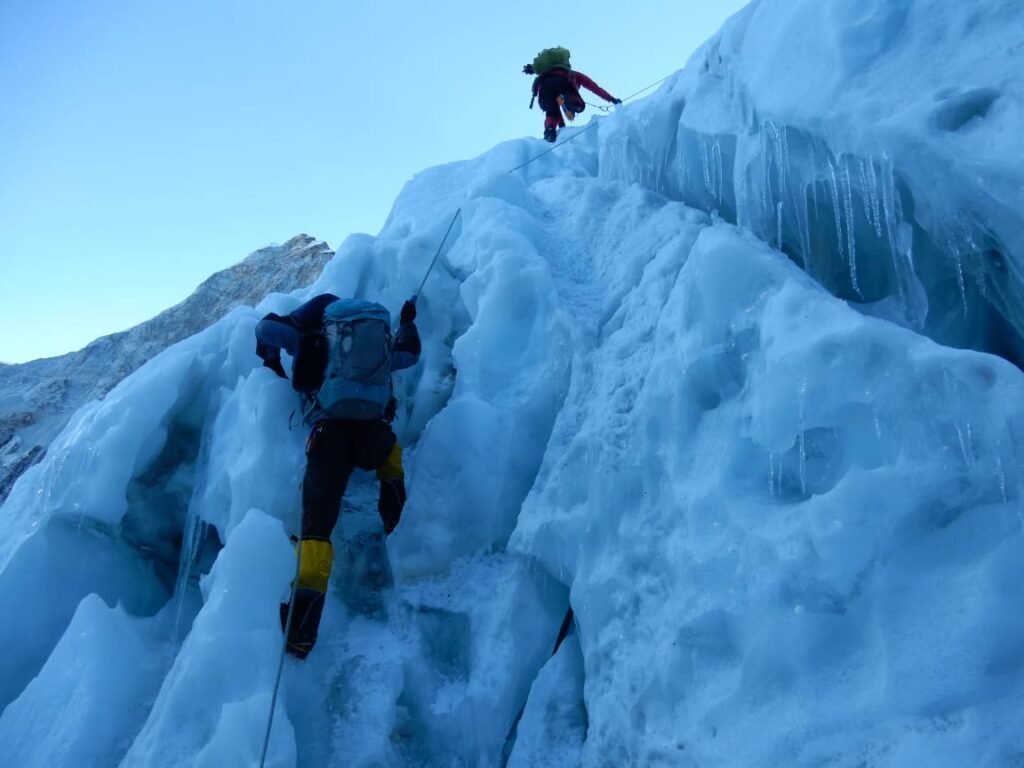
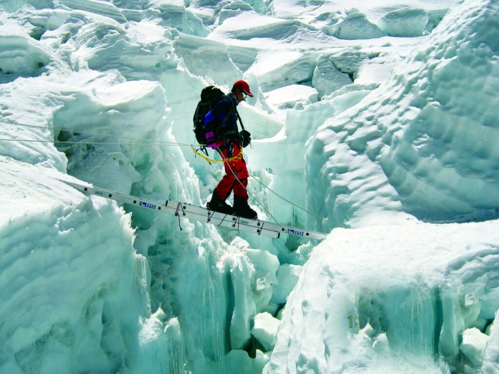
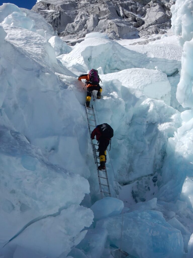
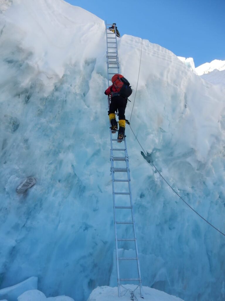
To get us acclimatized, on the 18th we climbed up into the Khumbu Icefall. We practiced different physical exercises and climbing techniques—ascending steep slopes, crossing wide crevasses over ladders. After rigorous climbing practice, we returned to Base Camp.
On the 19th, the Puja ceremony was held. Lamas arrived and began the rituals. After the prayers, the prayer flags were pulled and tied.
On April 20, the Sherpa team set out toward Camp One.
On the 21st, before dawn, we two started out. Three supporting members stayed back at Base Camp. We made our way up through the Khumbu Icefall, surrounded by fantastically shaped ice formations. Navigating past them, sometimes pulling ourselves up with ropes, sometimes climbing ladders.
After nearly ten hours of relentless movement, we reached Camp One at 6,000 meters, right at the foot of Nuptse. Here too were tents of many climbers from various countries. In front stretched a vast, limitless snowfield known as the “Valley of Silence.” We stayed together in a single tent.
Photostory: On the footsteps of History – Tichu Col revisited
On the 22nd, we descended back to Base Camp. This is standard practice in mountaineering. To acclimatize, this up-and-down movement continues constantly.
For the next three days we stayed at Base Camp. During this time, the Sherpa and cook teams had already headed toward Camps Two and Three—to prepare in advance.
Our journey resumed on April 26. Within six hours we reached Camp One.
The next day we began toward Camp Two, moving slightly southward and then east. On the far left was the Everest West Shoulder. Right of it is Everest’s wall. Straight ahead, where the Khumbu Glacier ends, rises Lhotse—8,516 meters, the fourth-highest mountain in the world. To the right stretched the entire Nuptse ridge.
Surrounded on three sides by rocky walls, a snowfield lay in the centre. This area is known as the Western Cwm. Along this route, within two hours, we reached Camp Two—6,400 meters—just beside the Everest slope. All sides except the northwest were enclosed. To the northeast stood Everest, to the east the South Col. Southeast lay Lhotse, and from the south to the west, the Nuptse ridge formed the boundary. All around, tents of many teams were scattered across the vast area.
April 29. Beyond Camp Two, we began climbing toward Camp Three at an altitude of 7,300 meters. Ahead lay a vast snowfield with a gentle incline. After walking for about two hours, that slope ended. Now came a steep wall of ice—the Lhotse Face.
he story ended exactly where it began. And the divine creation—Mount Everest—still stands there, unchanged. Only those few days in between passed like a dream. Across that entire journey, a new fairy-tale was written—one that many today call history.
We ascended along the wall, carefully pushing the jumar along the fixed rope. Every moment was breath-stopping. After climbing a long stretch, the tents of Camp Three were finally pitched.
The next day we descended again to Camp Two. On May 1, we returned to Base Camp. Then began a long wait. When would the weather forecast give the green signal? When would the ideal conditions arrive to attempt the summit?
At last, news came that the weather would be perfect from May 16 to 18, with very low wind. With the target of May 16 in mind, we set out from Base Camp on May 12 for the final summit push.
That very day we reached Camp Two. The next day was spent entirely at Camp Two. On May 14, we reached Camp Three.
May 15. We set out again. From here, each of us carried an oxygen cylinder in our backpack. Our target was Camp Four, the South Col—7,955 meters.
Climbing up along the flank of Lhotse, we then traversed northeast. Soon we reached the Yellow Band—a wall of yellow rock. Beyond it lay another snowfield. Continuing farther to the northeast, we encountered a black rocky wall—Geneva Spur.
Crossing that wall, and after walking for another half hour, we arrived at the South Col. To the north of the South Col rose Mount Everest, and to the south stood Lhotse.
The plan was to rest in the tent for a few hours and then set out the same night for the summit push. But by evening, fierce winds began. We were forced to remain at the South Col that day.
The next day, May 16, around eight at night, we started toward the final destination. In the backpack—oxygen cylinder, head torch, some basic medicines, a water bottle, and obviously camera. The temperature hovered near –25°C. As time would pass and the altitude increased, the cold would tighten its grip.
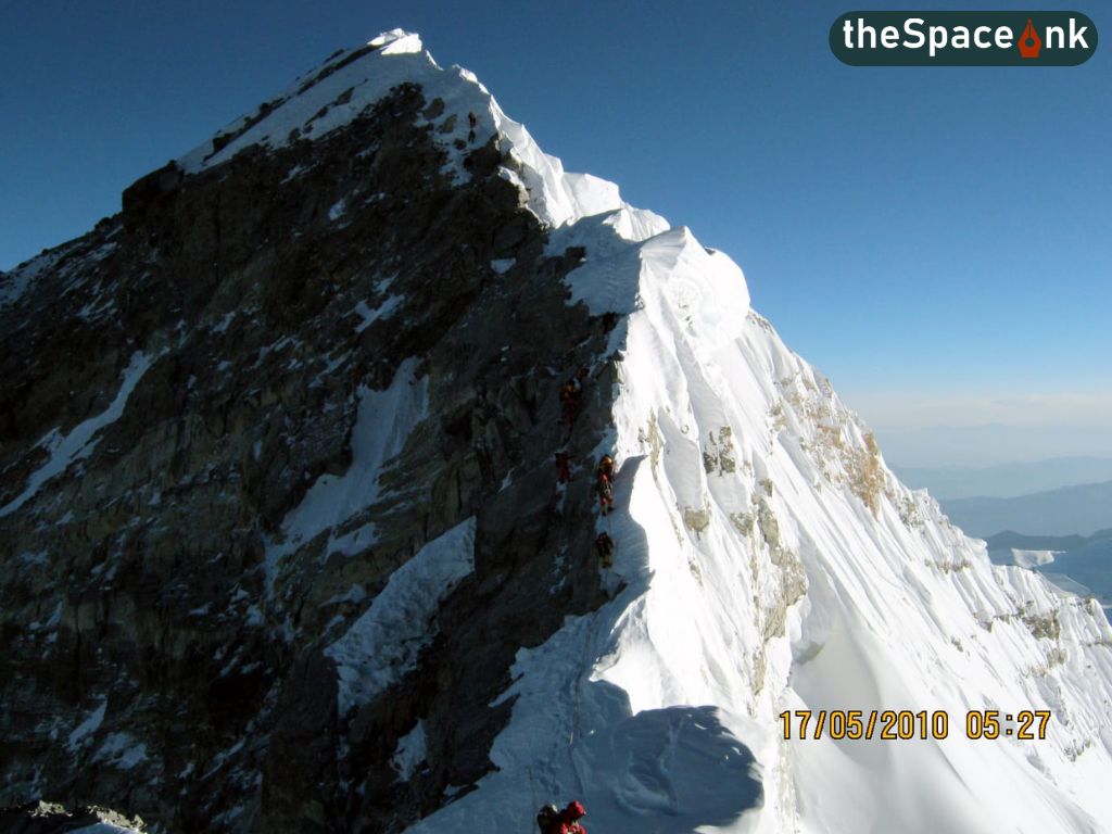
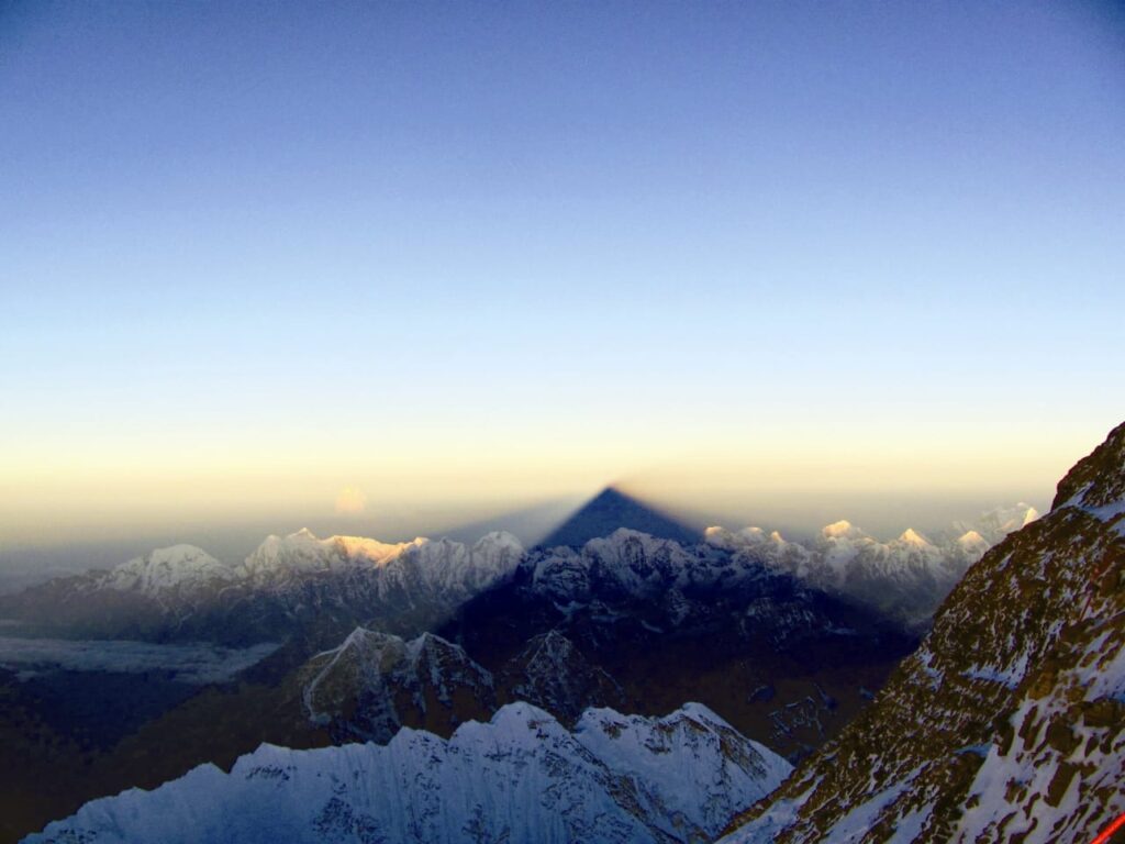
All through the night, we moved with utmost caution—pushing the jumar along the rope, step by step. Around four in the morning, a ring of light formed across the horizon. Soon, the sun rose. Across the western sky fell the shadow of Everest—an indescribably beautiful sight.
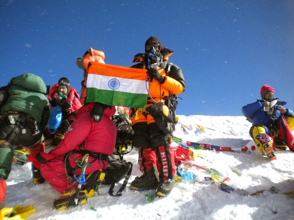
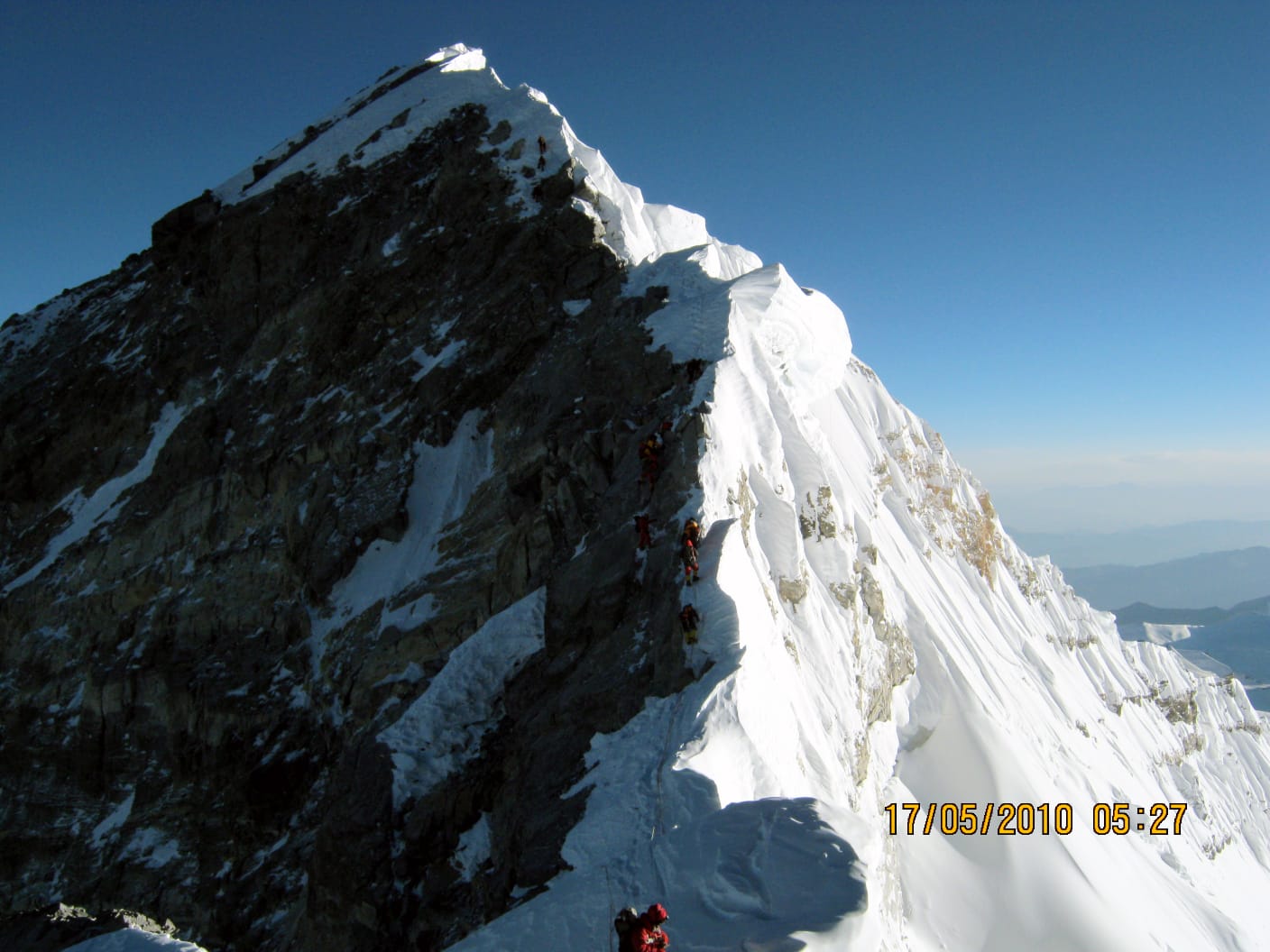
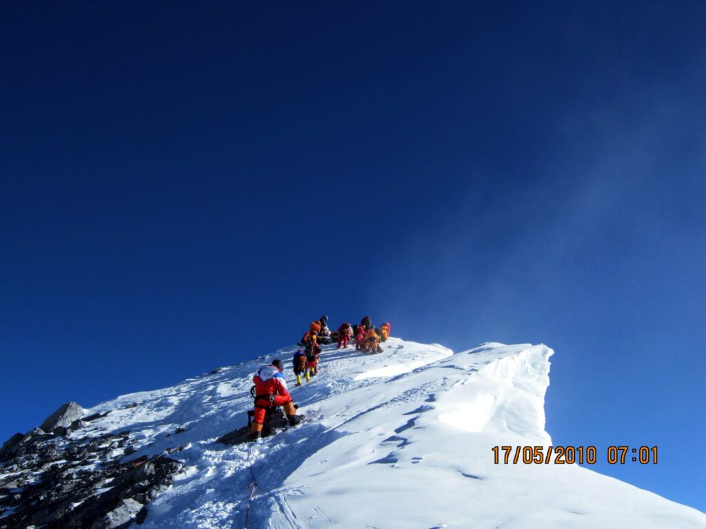
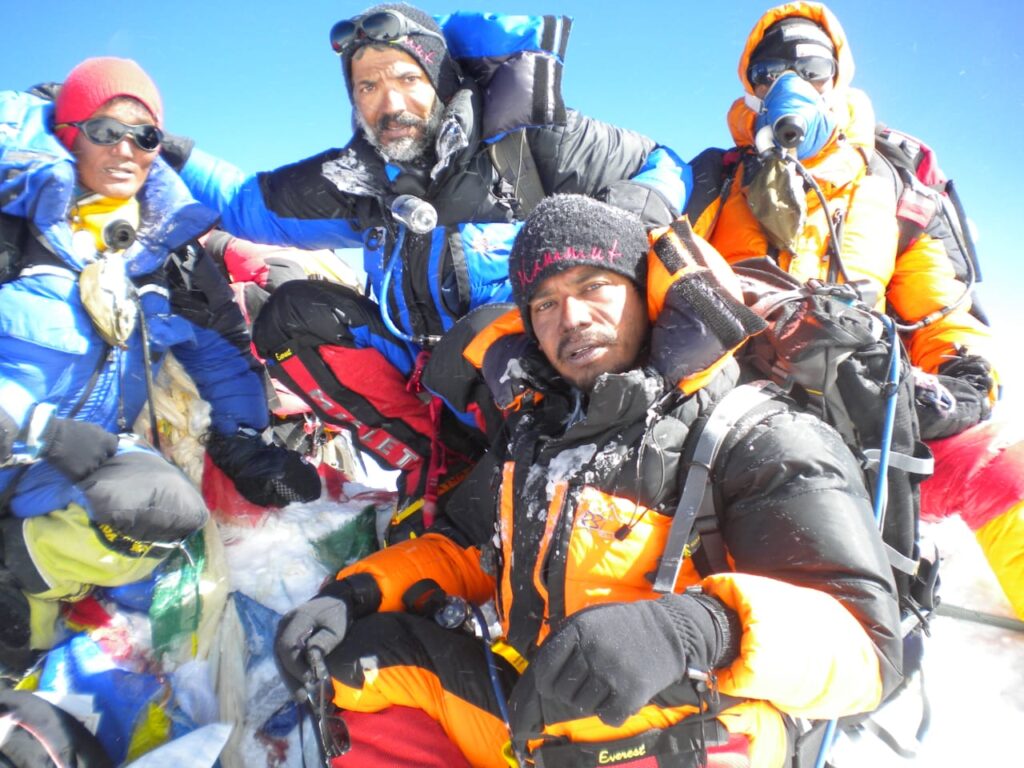
Right ahead stood the South Summit, a small peak just below Everest. Then came the Hillary Step. Crossing that, we climbed a gentle incline and reached the top of Mount Everest. The time was 7:45 a.m.
To the southeast stood Makalu, to the south Lhotse. Above us was nothing but the sky. Below us lay the whole world.
And thus, we became the first successful civilian summiteers from Bengal.
Two metal poles stand here, wrapped in Prayer flags and Khadas. Pemba was with me. About forty minutes later, Basanta arrived. Another half hour later came Pasang Sherpa. After that, we performed a puja. At nine o’clock we began the return.
Following the same route back, by one in the afternoon we reached Camp Four. That night we rested there. Next day we descended to Camp Two. On May 19 we returned to Base Camp. For the next two days we packed.
On the morning of the 22nd, we began the journey back. Passing through Namche, we reached Lukla on May 24. From there, the next day, a small plane took us to Kathmandu. On May 27, our aircraft landed in Kolkata.
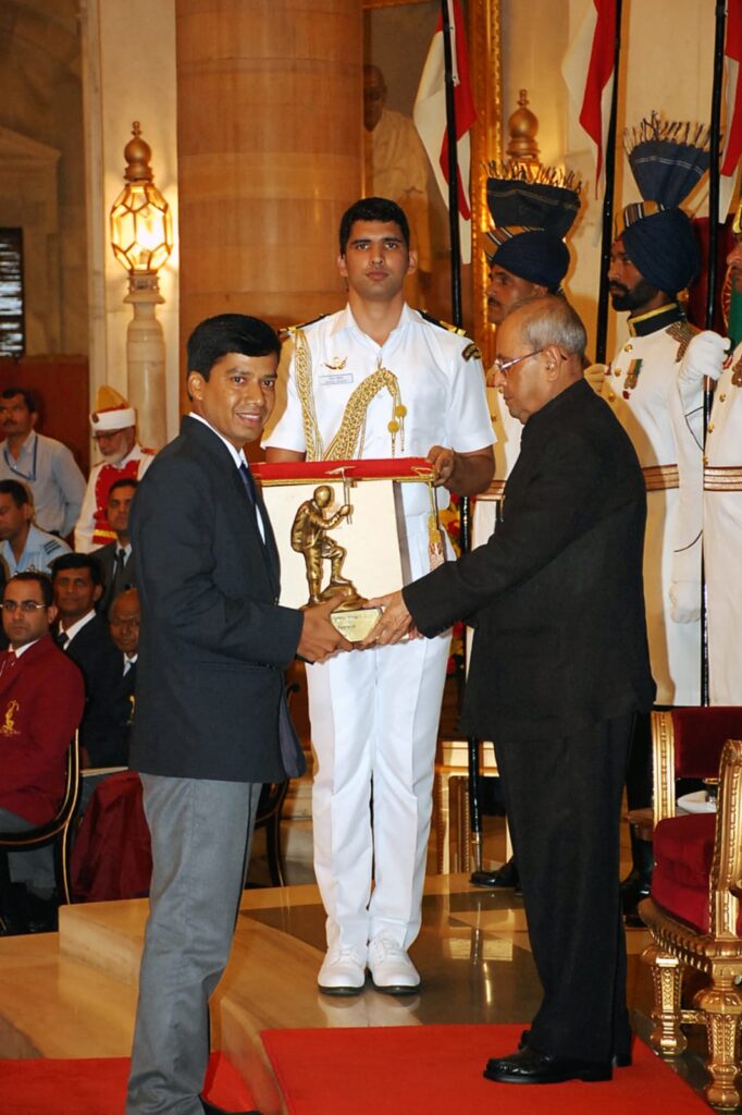
From this very Dum Dum Airport, the five of us had flown to Kathmandu on the first of April. The story ended exactly where it began. And the divine creation—Mount Everest—still stands there, unchanged. Only those few days in between passed like a dream. Across that entire journey, a new fairy-tale was written—one that many today call history.
Image Courtesy: Author

Debasish Biswas is a renowned mountaineer who has successfully climbed Mount Everest and Kanchenjunga. He was honoured with the Arjuna Award for his outstanding achievements in mountaineering. He has authored 21 books and directed 13 documentary films. He has also received an Honorary Doctorate in Youth Development for his significant contribution in that field. Professionally, he serves as the Joint Commissioner of Income Tax.